May 14 2015
Unmanned aerial vehicles are monitoring dryland ecosystems and soil erosion in a collaboration between New Mexico State University and the U.S. Department of Agriculture’s Agricultural Research Services at the Jornada Experimental Range, north of Las Cruces.
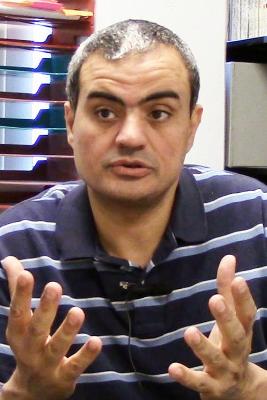 NMSU surveying engineering assistant professor Ahmed Elaksher is using UAVs to map soil erosion on the Jornada Experimental Range. (NMSU photo by Kristen Sullivan)
Leading the project for NMSU is Ahmed Elaksher, assistant professor of engineering technology and surveying engineering in the College of Engineering.
Remote sensing technology, such as aerial photography and satellite imagery, enables broad-scale observation and analysis of drylands. By comparison, field methods usually cover smaller areas.
Researchers at the Jornada Experimental Range are interested in measuring soil erosion over time. Field methods for measuring erosion, such as erosion bridges and pins, require a lot of field trips and often can only cover small areas.
Aerial photography is used via UAVs to monitor soil erosion on larger landscapes. From overlapping aerial photos, researchers create a time-series of digital elevation models. Differencing the elevation models helps researchers visualize and quantify soil movement.
Elaksher has been assisting the Jornada researchers with surveying ground control points for use in aerial triangulation. He also helped plan the image acquisition.
“Currently, these UAVs are mainly used for mapping more remote areas,” Elaksher said. “In the future, they may be used for remote mapping, urban planning purposes or to map highways or interstates.”
UAVs capture overlapping images of the ground. Using mathematical equations and software, Elaksher compiles the photographs to create a three-dimensional elevation/topographic map of the area.
“These UAVs operate the same way as our eyes,” Elaksher said. “One eye allows us to see one particular area and the other eye allows us to see another particular area. When the two areas overlap, we are able to see depth.”
Jeffrey Gillan, assistant professor at NMSU and remote sensing specialist at the Jornada Experimental Range, has worked extensively with Elaksher to measure vegetation height and soil erosion over time. The Jornada Experimental Range is a research station dedicated to studying rangeland and dryland ecology, including animal behavior and soil science.
“Ahmed has extensive background in photogrammetry and surveying, which helps with the theoretical side of our research,” Gillan said. “We are primarily interested in how soil surface moves over time.”
When Gillan first came to NMSU, he was interested in mapping soil using aerial photogrammetry but he wanted the assistance of someone who was better versed in the technical and theoretical side of photogrammetry. He reached out to Elaksher, who agreed to help. One of the projects Gillan and Elaksher collaborated on was 3D mapping of study sites in Lake Mead National Recreation Area, Nevada, and Mojave National Preserve, California.
Locally, Gillan and Elaksher have partnered to monitor soil erosion through the use of UAVs at the Jornada Experimental Range.
One traditional method of monitoring soil erosion is through an erosion bridge. Erosion bridges enable researchers to create topographic profiles of the land surface. Then, they create a time-series of elevation profiles to see how soil has moved. This is done on a small scale of 1 to 10 meters. The erosion bridges can often be cumbersome and difficult to measure an expansive distance, making UAVs preferable.
Despite being easier to measure over an expansive distance, commercial and research UAVs require permission from the Federal Aviation Administration, a runway and a crew to fly the UAV. UAVs are often large. For example, one of the UAVs Elaksher and Gillan use for their research has a wingspan of 13 feet.
The results from the images taken from the UAV can be developed into a point cloud, which maps each point on the ground in 3D space. The points form coordinates, which can be used to measure and map the ground soil and vegetation. UAVs are capable of taking extremely high-resolution photos, which result in clear and easy to distinguish points. The pixels in imagery are equal to two centimeters on the ground.
“We can measure the height of visible points on the ground,” Elaksher said. “We can measure the heights of points over the years and compare them to a few control points, which we then compare to find out how much the soil has eroded.”
Photogrammetry has applications outside of research. In World War I, this technology played an essential role in gathering reconnaissance and intelligence. Over time, the technology developed into a scientific field. In addition, photogrammetry can also be used to map historical buildings to determine the condition and the maintenance needed. Photogrammetry is also used to map archaeology sites and to develop topographic maps.
Source: http://www.nmsu.edu/