Unmanned aerial vehicles, or drones, can collect detailed information in real time at relatively low cost for ecological research. In a new Opinion piece published in the Cell Press journal Trends in Parasitology, experts demonstrate that drones can be used to understand how environmental factors influence the spread of infectious diseases.
 This image shows use of the Sensefly eBee to map land cover in Malaysia. Credit: Trends in Parasitology, Fornace et al.
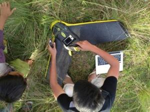
"Drones can provide highly accurate information on changes to land, such as deforestation or changing types of agriculture. This helps to understand the impact on the movement and distribution of people, animals, and insects that carry disease," says lead author Kimberly Fornace, of the London School of Hygiene and Tropical Medicine, in the UK.
For their studies on a species of human malaria that is also carried by monkeys, as part of a larger project funded by the UK Research Council Living with Environmental Change initiative, Fornace and her colleagues are using a drone to map changes in mosquito and monkey habitats and correlate how those changes affect human infection. Drone data are used alongside hospital cases and data on mosquito and monkey abundance to understand disease risks.
The investigators noted that one of the main benefits of using drones is the ability to obtain data in real time and to repeatedly map areas of interest as frequently as required. For example, at one of their sites in Malaysia, a forest was being cleared to establish a rubber plantation, and progress of the clearing and the resulting land changes could be mapped quickly and updated routinely. This ability to map changes as they occur is critical for understanding how land use change affects the distribution of human populations and disease-carrying organisms.
The researchers stressed that smaller drones likely to be used for research have some limitations, however, including the inability to withstand certain weather conditions and to travel over vast land areas. As this is a relatively new technology, researchers may also face challenges related to gaining permission to carry out drone-derived mapping. Despite these limitations, drones provide a useful new source of detailed spatial information to understand the interactions between the environment and infectious diseases.